-CLIENT-
Ohio State University, Woolpert Inc.
-TECHNOLOGIES-
ArcGIS, dojo, jQuery, jQueryUI
Geographic Information System Web App
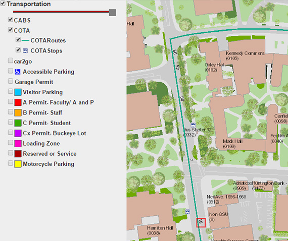
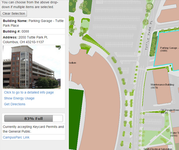
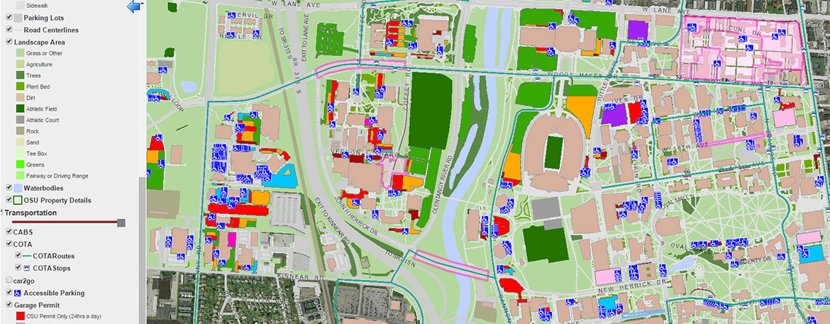
InSource Pro worked with the client’s business data team to identify the important GIS data points which would be required to serve both academic and administrative projects requiring fast access to GIS data for all campuses. InSource Pro developed an interface that leveraging layered Google Map data with University data and public GIS data to create a comprehensive resource that can display the following data: A Base Map of all campus infrastructure and planned infrastructure, A City map to represent the surrounding urban area , A Transportation routing, & A Street and Satellite view of city and campus. Customers can turn on layers within the display to see data in any combination to meet their individual needs. Specific data can be obtained by clicking on an individual building or drawing a shape on the map to collect data for a specific geographic area. There are search capabilities to search by text to locate specific landmarks. There is also capability to download specific GIS data from the map to support additional projects and research.
Access the map here: gismaps.osu.edu